|
全球土地利用数据集 【数据下载】
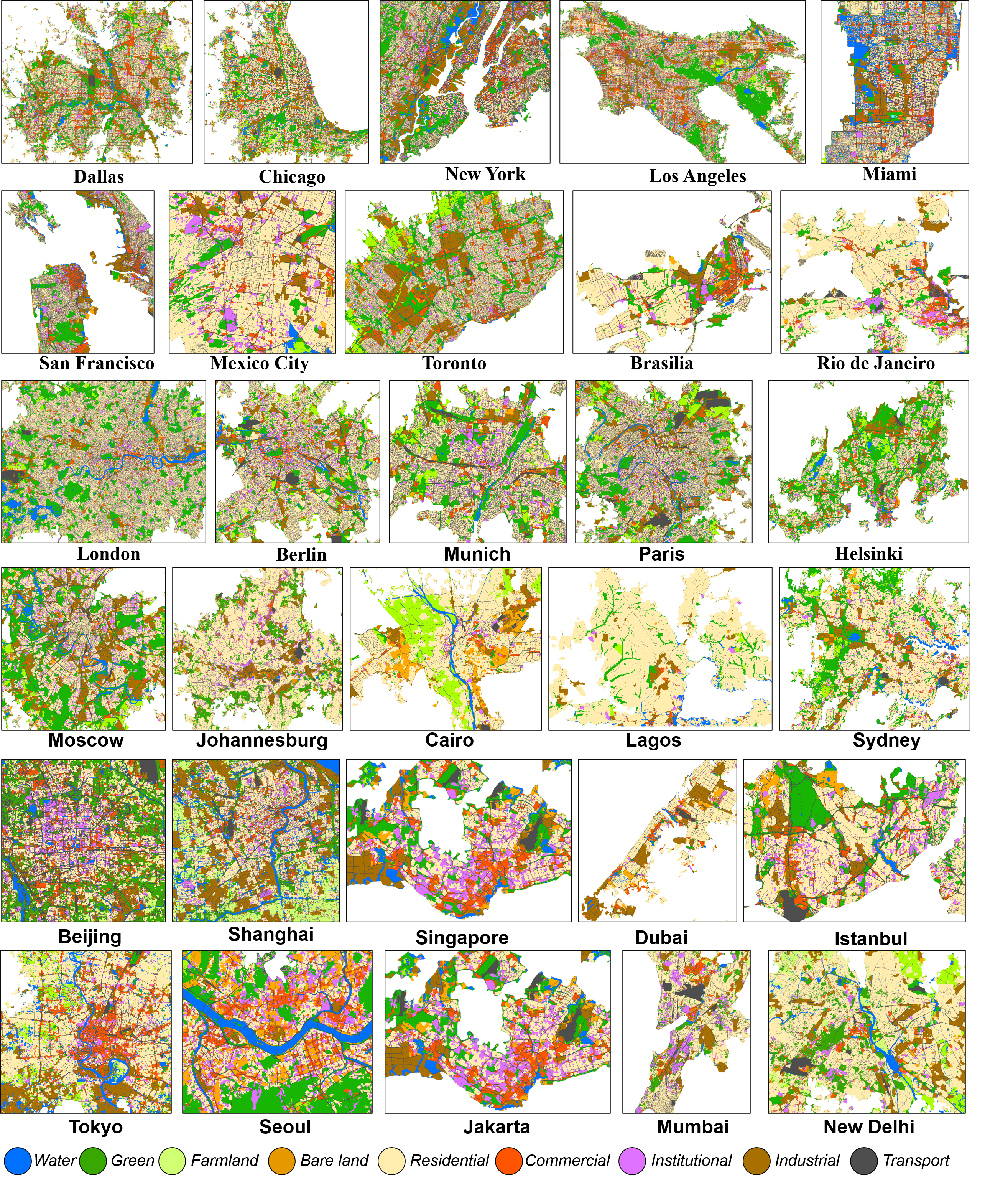
数据简介:该数据集系统刻画了2020年全球城市地区的土地利用空间格局,具备统一的空间分辨率(10 m)和一致的分类体系,是目前少有的高分辨率全球城市土地利用产品之一。 数据集覆盖全球主要城市区域,能够在统一分类体系下反映不同国家和地区城市土地利用结构及其空间差异,为跨区域、跨国家的城市比较研究提供了可靠的数据基础。数据集的坐标系为EPSG:3857,数据集编号1-9对应的用地类别分别是:1:水体,2:绿地,3:农田,4:裸地,5:居住用地,6:商业用地,7:教育机构,8:工业用地,9:交通用地
Introduction:This dataset systematically characterizes the spatial patterns of land use in global urban areas in 2020, featuring a uniform spatial resolution (10 m) and a consistent classification system. It is one of the few high-resolution global urban land use products currently available. The dataset covers major urban areas worldwide, reflecting urban land use structures and their spatial differences across different countries and regions under a unified classification system, providing a reliable data basis for cross-regional and cross-national urban comparative studies. The dataset uses the EPSG:3857 coordinate system, and the land use categories corresponding to dataset numbers 1-9 are: 1: Water bodies, 2: Green spaces, 3: Farmland, 4: Bare land, 5: Residential land, 6: Commercial land, 7: Educational institutions, 8: Industrial land, 9: Transportation land.
|
|
|
|
[1] Xiong, S., Zhang, X., Wang, H., Lei, Y., Tan, G., & Du, S. (2025). Mapping the first dataset of global urban land uses with Sentinel-2 imagery and POI prompt. Remote Sensing of Environment, 327, 114824. https://doi.org/10.1016/j.rse.2025.114824
|
|


